
The North Pole is interesting. The plans for creating an amusement park began in 1955. Modeled after Santa’s Workshop in Lake Placid, NY, construction was completed and the park opened in 1956. In the center of the village is a Frozen North Pole that stays frozen no matter how warm it gets!! This is a really neat thing to do one afternoon—my son loves the North Pole! If you have the chance, you can send postcards postmarked with a North Pole postmark….
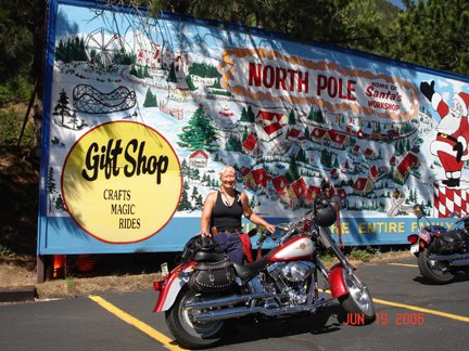 The North Pole
Since the park is located at the base of Pike’s Peak, it only made common sense to get the entrance to The Peak. I asked Betty if she was game to riding The Peak…nooooo….not today! She’s open to doing it and I think she will….just not today!! So the shot of the entrance will do. There is a motorcycle run up Pike’s Peak next month. Count me in to be there—I want to ride it with my friends to the top!! I did it last year and loved it, so it’s penciled in on my calendar this year.
 The Entrance to Pike's Peak
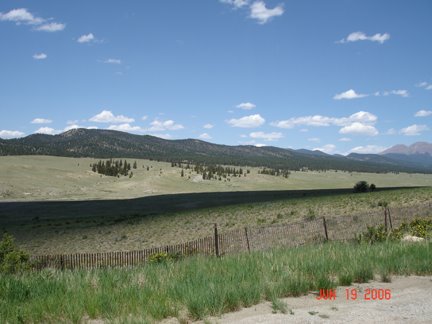
Next stop is Wilkerson Pass. Getting to Wilkerson Pass is easy…go west on Highway 24 until you see the sign. I had ridden to Wilkerson Pass on Sunday and it was cold enough to wear a jacket. When Betty and I rode on Monday, I was in a shirt. What a difference one day makes!!
 Observation deck at Wilkerson Pass
Photo op time, get the required Scavenger Hunt items, talk to the folks at the Visitor Center…mount up and back on the road. The plan was to get to Buena Vista and stop for lunch. There were too many roadside opportunities to stop and shoot an image or two…at this rate, we are never going to make lunch at Buena Vista! Well, we didn’t….we ended stopping at a great Mexican restaurant in Johnson Village.
 Hwy 24 side of the road stop
 Another Hwy 24 side of the road stop
Stomachs full, we head out in a northerly direction: Leadville. The road up is designated a scenic byway and is called the Top of the Rockies Scenic and History Byway. It is gorgeous!! While I’m riding the highway down in the mountain ranges, I had a thought…”wow, there are a lot of ROCKS everywhere”. Duhhhh…Christine…we are in the ROCKY MOUNTAINS after all! I guess I’m guilty of not really paying close attention. I would have loved to stop and shoot a million images, but it was already on the other side of lunch and we had a way to go!
 Lots o' rocks...at the National Forest Sign!
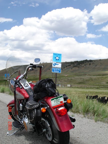 Top of the Rockies Scenic Byway
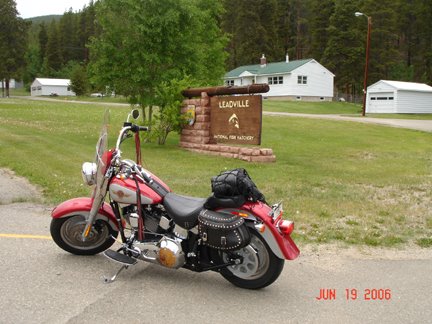 Cool..Leadville Fish Hatchery...it's the WRONG one!!
We pulled in to shoot the image of the sign. As we were busy with our cameras, a gentleman stopped and told us about Turquoise Lake. I thanked him and we mounted up and headed out to get back on the highway. Ironically, the image of the fish hatchery is incorrect—the list has a fish hatchery…we just got the wrong one! Turquoise Lake, which we rode right by….we decided against going since the weather was deteriorating…WAS on the list. Gee…Mr. Murphy was up to his old tricks, eh??
Betty and I get to Leadville and gas up. I’m still not wearing a jacket. It’s a bit cool, but not too terribly bad. A gentleman pulls up on his Harley and asks me “aren’t you cold”? He’s in full gear—dressed for a blizzard! It was too funny!!
Leadville, at 10,430 feet, is designated as North America’s highest incorporated city. It is a great town—with 310 days of sunshine and temps that rarely get over 80 degrees! Of course, I’m thinking of the low temps in the dead of winter!! Brrrrrrrrrrrrrr.
The National Mining Museum is located in Leadville, so we followed the signs without mishap to the museum. The museum looked interesting—and if we weren’t time limited I’d have spent more time than a cursory visit. Next time….next time. At this rate, I’ve got so many mental notes to see all these places that I am not sure I’ll get there in this lifetime. I’m going to try, however *smile*.
 The National Mining Museum
I look forward to the 5-in-1 next month. The end spot is in Leadville so I’ll make a point to break away from the festivities and check out the museum. I think it will be a lot of fun to visit all the little shops too!!
Well, we have quite a bit of way to go from Leadville, but at this point, this story ends. I really do need to get off this computer, do some homework and get packed for my motorcycle adventure that starts tomorrow!!!
Keep the Shiny Side Up!
~The Rainbow Wahine
1 comment:
whoa! busy day! sounds like it was lots of fun though.
Post a Comment